Hollis Center 🇺🇸
-
Nautical Twilight begins:05:20 amSunrise:06:21 am
-
Sunset:06:54 pmNautical Twilight ends:07:55 pm
-
Moonrise:-
-
Moonset:03:52 pm
-
Moon over:07:44 am
-
Moon under:08:04 pm
-
Visibility:37%
-
 Third Quarter Moon
-
Distance to earth:370,142 kmProximity:83.5 %
Moon Phases for Hollis Center
-
average Day
-
major Time:06:44 am - 08:44 am
-
minor Time:02:52 pm - 04:52 pm
-
major Time:07:04 pm - 09:04 pm
-
minor Time:11:16 pm - 01:16 am
Tide Clock
Tide Graph
Times
| Tide | Time | Height |
|---|---|---|
| low | 12:06 am | 0.13 ft |
| high | 06:09 am | 8.43 ft |
| low | 12:18 pm | 1.15 ft |
| high | 06:26 pm | 9.71 ft |
| Date | Major Bite Times | Minor Bite Times | Sun | Moon | Moonphase | Tide Times |
|---|---|---|---|---|---|---|
|
Mon, 15 Sep
|
06:44 am -
08:44 am
07:04 pm -
09:04 pm
|
02:52 pm -
04:52 pm
11:16 pm -
01:16 am
|
R: 06:21 am S: 06:54 pm |
R: - S: 03:52 pm |
Third Quarter Moon |
low: 12:06 am
, 0.13 ft
high: 06:09 am
, 8.43 ft
, Coeff: 91
low: 12:18 pm
, 1.15 ft
high: 06:26 pm
, 9.71 ft
, Coeff: 117
|
|
Tue, 16 Sep
|
07:26 am -
09:26 am
08:03 pm -
10:03 pm
|
03:36 pm -
05:36 pm
11:16 pm -
01:16 am
|
R: 06:22 am S: 06:52 pm |
R: 12:16 am S: 04:36 pm |
Waning Crescent |
low: 01:16 am
, 0.36 ft
high: 07:21 am
, 8.3 ft
, Coeff: 89
low: 01:29 pm
, 1.28 ft
high: 07:38 pm
, 9.58 ft
, Coeff: 115
|
|
Wed, 17 Sep
|
08:19 am -
10:19 am
08:56 pm -
10:56 pm
|
12:30 am -
02:30 am
04:09 pm -
06:09 pm
|
R: 06:23 am S: 06:50 pm |
R: 01:30 am S: 05:09 pm |
Waning Crescent |
low: 02:25 am
, 0.36 ft
high: 08:29 am
, 8.4 ft
, Coeff: 91
low: 02:38 pm
, 1.15 ft
high: 08:46 pm
, 9.65 ft
, Coeff: 116
|
|
Thu, 18 Sep
|
09:09 am -
11:09 am
09:45 pm -
11:45 pm
|
01:44 am -
03:44 am
04:35 pm -
06:35 pm
|
R: 06:24 am S: 06:48 pm |
R: 02:44 am S: 05:35 pm |
Waning Crescent |
low: 03:28 am
, 0.26 ft
high: 09:30 am
, 8.69 ft
, Coeff: 97
low: 03:41 pm
, 0.89 ft
high: 09:46 pm
, 9.78 ft
, Coeff: 119
|
|
Fri, 19 Sep
|
09:56 am -
11:56 am
10:31 pm -
12:31 am
|
02:56 am -
04:56 am
04:57 pm -
06:57 pm
|
R: 06:25 am S: 06:47 pm |
R: 03:56 am S: 05:57 pm |
Waning Crescent |
low: 04:22 am
, 0.13 ft
high: 10:23 am
, 8.99 ft
, Coeff: 103
low: 04:35 pm
, 0.59 ft
high: 10:38 pm
, 9.88 ft
, Coeff: 121
|
|
Sat, 20 Sep
|
10:40 am -
12:40 pm
11:13 pm -
01:13 am
|
04:05 am -
06:05 am
05:15 pm -
07:15 pm
|
R: 06:27 am S: 06:45 pm |
R: 05:05 am S: 06:15 pm |
New Moon |
low: 05:09 am
, 0.07 ft
high: 11:08 am
, 9.28 ft
, Coeff: 109
low: 05:24 pm
, 0.33 ft
high: 11:25 pm
, 9.88 ft
, Coeff: 121
|
|
Sun, 21 Sep
|
11:22 am -
01:22 pm
10:49 pm -
12:49 am
|
05:11 am -
07:11 am
05:33 pm -
07:33 pm
|
R: 06:28 am S: 06:43 pm |
R: 06:11 am S: 06:33 pm |
New Moon |
low: 05:52 am
, 0.07 ft
high: 11:49 am
, 9.45 ft
, Coeff: 112
low: 06:07 pm
, 0.2 ft
|


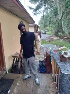
uploaded by: Heathen Monk

uploaded by: Flounder pounder

uploaded by: Stephen Spencer

uploaded by: Jon “Kuse”

uploaded by: Elzen Harris

uploaded by: RAMason69

uploaded by: Steven Butcheck

uploaded by: Joey Piercefield

uploaded by: Hoza

uploaded by: John Matthews
Best Fishing Spots in the greater Hollis Center area
Wharf's or Jetties are good places to wet a line and meet other fishermen. They often produce a fresh feed of fish and are also great to catch bait fish. As they are often well lit, they also provide a good opportunity for night fishing. There are 1 wharf(s) in this area.
Whites Wharf - 17km
Beaches and Bays are ideal places for land-based fishing. If the beach is shallow and the water is clear then twilight times are usually the best times, especially when they coincide with a major or minor fishing time. Often the points on either side of a beach are the best spots. Or if the beach is large then look for irregularities in the breaking waves, indicating sandbanks and holes. We found 1 beaches and bays in this area.
Lower Bay - 20km
We found a total of 71 potential fishing spots nearby Hollis Center. Below you can find them organized on a map. Points, Headlands, Reefs, Islands, Channels, etc can all be productive fishing spots. As these are user submitted spots, there might be some errors in the exact location. You also need to cross check local fishing regulations. Some of the spots might be in or around marine reserves or other locations that cannot be fished. If you click on a location marker it will bring up some details and a quick link to google search, satellite maps and fishing times. Tip: Click/Tap on a new area to load more fishing spots.
Bar Mills Dam - 3km , Cooks Brook Dam - 3km , Skelton Dam - 5km , Bartlett Pond - 6km , Lily Pond - 7km , West Buxton Dam - 7km , Deer Pond - 7km , Wales Pond - 7km , Roberts-Wadley Pond Dam - 8km , Duck Pond - 8km , Wadley Pond - 8km , Parker Pond - 8km , Little Ossipee Pond - 9km , Tarwater Pond - 9km , Bonney Eagle Dam - 9km , Roberts Pond - 9km , Round Pond - 10km , Swan Pond - 10km , Killick Pond - 10km , Bonny Eagle Pond - 10km , Isinglass Pond - 11km , Edgecomb Bridge - 11km , Sand Pond - 11km , Goodwins Mills Dam - 11km , Little Ossipee Pond Dam - 11km , Boyd Pond - 12km , Kennebunk Pond - 12km , Ledgemere Dam - 12km , Doles Pond - 13km , Moody Pond - 13km , Foss Ponds - 13km , Bunganut Pond - 14km , Big Island - 15km , Middle Island - 15km , Brimstone Pond - 16km , Shaker Pond - 16km , West Channel Dam - 16km , Treasure Island - 16km , Blueberry Island - 16km , Middle Branch Pond - 16km , Bradley-Springs Island Dam - 16km , Watchic Pond Dam - 16km , Springs Island - 16km , Factory Island - 17km , Whites Wharf - 17km , North Limington Dam - 17km , Davis Pond - 17km , Cataract Dam - 17km , Mouse Island - 18km , Pickerel Pond - 18km , Wilcox Pond - 18km , Wards Pond - 18km , Cow Island - 18km , Junkins Point - 18km , Cow Island Ledge - 18km , Gordon Point - 18km , Trafton Brook Dam - 18km , Little Watchic Pond - 19km , Alewife Pond - 19km , Pequawket Dam - 19km , Otter Ponds - 19km , Thunder Island - 19km , Mallison Falls Dam - 19km , Snake Pond - 19km , Sokokis Lake Dam - 19km , Edgecomb Point - 20km , Gambo Falls Dam - 20km , Hills Point - 20km , Little Falls Dam - 20km , Rich Mill Pond Dam - 20km , Lower Bay - 20km
Comments